
Discover the Amazing Features of Google Earth
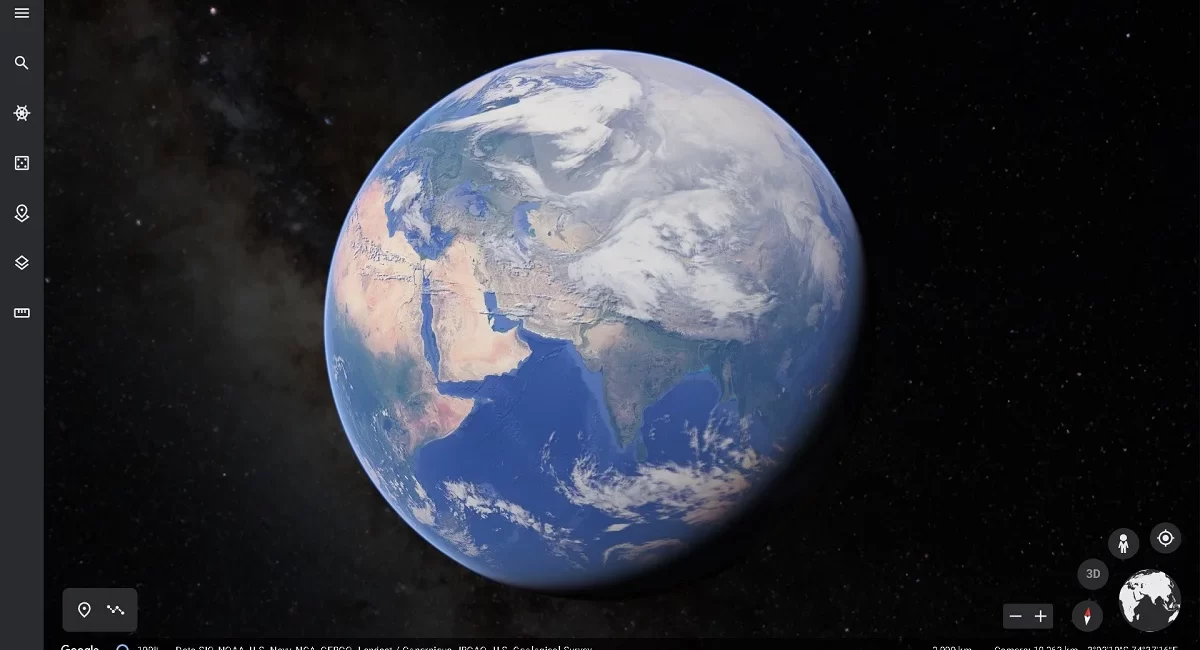
Originally known as EarthViewer 3D, Google Earth is a virtual globe, map, and geographic information software. It was developed by Keyhole, Inc., a business backed by the Central Intelligence Agency (CIA) and bought by Google in 2004.
Google Earth offers a 3D view of the earth and includes a number of features, such as:
- Imagery from space: You may examine high-resolution satellite and aerial images of cities, landscapes, and other geographical features.
- Street View: Street View offers panoramic 360-degree views of streets and places all over the world.
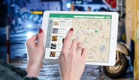
- Maps: Users have access to maps, travel instructions, and data on places and companies.
- Places of Interest: Google Earth offers details and images of well-known monuments, popular vacation spots, breathtaking natural sights, and other places of interest throughout the globe.
- Users can view 3D models of buildings and terrain in a few towns and places. 3D Building and Terrain
- Users can see historical imagery of particular locales to see how those places have changed through time.
- Mars’ surface and the ocean’s floor may both be explored by users using Google Earth.
- Geo-Location Data: Users of Google Earth can examine and interact with geo-located data, such as statistics, forecasts, and traffic conditions.
On desktop computers, as well as for iOS and Android mobile devices, Google Earth is free to use. The programme offers a thorough virtual picture of the world and is widely used for educational, scientific, and commercial purposes.
You can utilize a variety of free tools provided by Google Earth to get familiar with its features and maximize its potential. You may learn Google Earth for free in the following ways:
- The Google Earth Help Center is a comprehensive source for information about the application and its features. It offers in-depth articles, videos, and tutorials on subjects including how to utilise Street View, travel the world, and make your own unique maps and tours.
- YouTube Tutorials: Google Earth offers a wide selection of instructional and lesson YouTube videos. You may learn more about individual features as well as useful hints and techniques from these videos to help you use the application more efficiently.
- Google Earth Community: The Google Earth Community is a message board where users may connect with other Google Earth fans and ask questions or provide advice. To learn from other users, you can join the community and take part in discussions.
Google Earth is used by people for many different things, such as:
- Education: Students can learn about geography, history, and science by using Google Earth in schools and other educational settings. The application helps educators design engaging courses and virtual field trips that bring concepts to life.
- Environmental & conservation: To monitor and research the earth’s ecosystems and natural resources, scientists, government agencies, and environmental organizations utilize Google Earth.
- Urban Planning and Development: To visualise and plan new developments as well as to research and analyse current cities and neighbourhoods, urban planners, architects, and real estate developers utilise Google Earth.
- Disaster Response: To evaluate the damage and react to natural disasters and humanitarian crises, emergency personnel and humanitarian groups utilise Google Earth.
- Adventure and travel: Google Earth is also used by travelers and adventurers to research new locations, make vacation plans, and find undiscovered attractions throughout the world.
Google Earth offers a plethora of resources and tools for discovering, comprehending, and learning about our globe. You can get the most out of Google Earth and utilise this potent tool to its full potential by taking advantage of the free training materials and learning about the program’s features and capabilities.
To guarantee a great experience for all users and to uphold the integrity of the service, users should adhere to Google Earth’s rules and best practices.
hints for using Google Earth:
- Respect Privacy: Ask the owner’s permission before disclosing any private information or property.
- Respect Copyright: Avoid using Google Earth to violate the rights of others to their photographs and geographic information.
- Use Google Earth only to display appropriate stuff; do not exhibit offensive or inappropriate material.
- Accuracy: When producing material for Google Earth, ensure sure the data is correct and current.
Google Earth’s best practices:
- Keep it Simple: Concentrate on writing material that is relevant to your target audience that is clear, succinct, and simple to understand.
- Use High-Quality Imagery: To improve and visually appealing your content, use high-resolution satellite and aerial imagery.
- Use Interactive Components: Include interactive elements in your content to enhance depth and interest. Examples include pop-up windows.
- Make it Shareable: Distribute your Google Earth content to others by email, social networking, or website embedding.
- Use Custom Tours: Design customised tours to lead users through your material and draw attention to particular spots and features.
- Keep Content Current: To keep your content current and accurate, update it frequently.
You may provide high-quality, interesting, and educational material for Google Earth that is available to and helpful for all users by adhering to these recommendations and best practices.

Leave a Comment